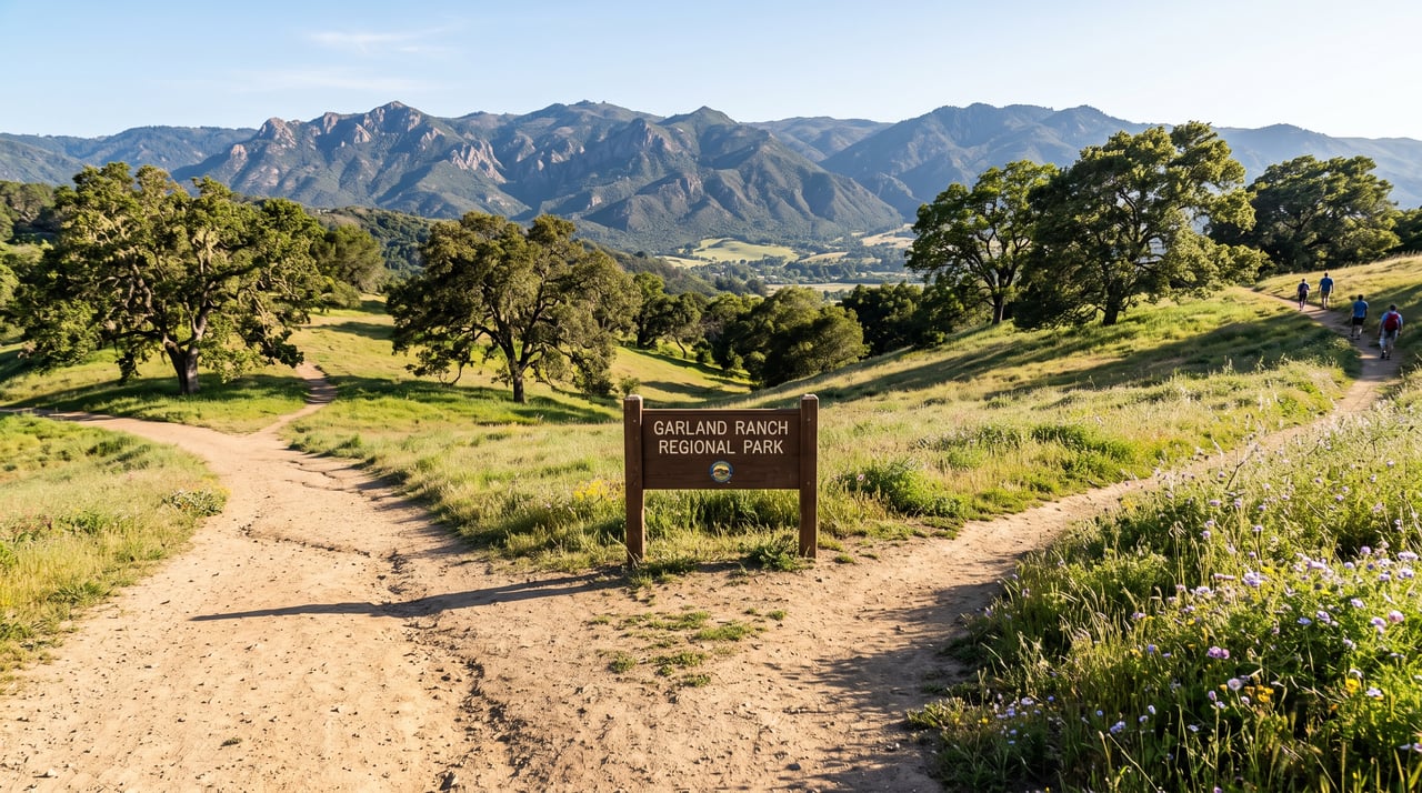
You cross the steel footbridge at 8:15 on a Tuesday, the Carmel River low and glassy underneath, and by the time you've made the loop back toward the Visitor Center you notice the door is closed. Not locked-for-lunch closed. Dark. A sign confirms it: Thursday through Sunday, 10 to 4, open Monday holidays.
For a park that most Carmel Valley Road residents treat as a backyard, that is the small structural change to absorb first this summer. The park itself, at 3,464 acres with something in the range of 50 to 60 miles of trail, has not changed. What has changed is the schedule around it. The rhythm the regulars have been walking for years is being quietly rebuilt around a smaller, more organized visitor operation, and 2026 is the year that shows up.
The Visitor Center Now Runs a Four-Day Week
The Monterey Peninsula Regional Park District posted the new Visitor Center hours on its homepage this year: Thursday through Sunday, 10 a.m. to 4 p.m., with the center opening on Monday holidays. The volunteer-staffed desk at 700 West Carmel Valley Road remains the place to pick up a loaner trail map, ask a ranger a routing question, or borrow a species checklist, but the Monday-through-Wednesday window that longtime walkers once used for a quick map exchange is gone.
Practically, this means the weekday routine has shifted. If you rely on the docent to confirm which upper trails are dry, or to warn you about a downed oak on East Ridge, that conversation now belongs to a Thursday or Friday morning walk. The Visitor Center phone, (831) 659-6065, still answers, and the District's main line at (831) 372-3196 covers the rest of the week, but the in-person exchange is a four-day amenity now.
The October 31, 2025 e-news also noted that Garland Ranch was voted Best Hiking Trail again, which is the kind of recognition that draws weekend visitors from Salinas and San Jose who have never been. For anyone walking in from Boronda or Robinson Canyon, the practical read is straightforward: Saturday and Sunday between 10 and 2 will feel busier at the trailhead than the same window did in 2023.
The Bridges That Aren't There Right Now
The November 25, 2025 District e-news confirmed something the morning regulars had already noticed on foot: the seasonal bridges at Garland Ranch Regional Park have been removed for the winter. The year-round steel bridge downstream of the main lot remains in place. The summer footbridge closer to the Visitor Center does not.
That routing detail matters more than it sounds. If you park at the main lot and habitually cross toward the Visitor Center on the near bridge, you are now looping down to the year-round crossing and doubling back. It adds roughly a quarter mile to what used to be a clean approach to the Lupine Loop, and it changes how you plan a river-and-Mesa combination. For anyone with a dog on voice recall or a stroller, the year-round steel span downstream is the only reliable dry-foot option until crews reinstall the seasonal structure later in the season.
The floodplain hydrology under all of this is not incidental. The Carmel River corridor here supports Monterey cypress, Monterey pine, coast live oak woodland, and redwood ecosystems, and the seasonal bridge cycle exists because the willow-lined banks and cottonwood-sycamore floodplain do flood. The reason the bridge is not there in May is the same reason it can be there in September.
Weekend Warriors, Round 2
The January 30, 2026 e-news announced Weekend Warriors: Round 2, the District's second cycle of a weekend trail-work volunteer program. Round 1 in 2025 pulled enough participation to run it again, and for residents who already walk these trails, this is the version of civic engagement that requires no meeting.
The MPRPD volunteer program has run for more than 30 years and pairs trail monitors with ranger staff, offers training in natural history and interpretation, and provides seven enrichment events per year with local scientists and naturalists giving special talks and field trips. The Weekend Warriors track is the shorter-commitment on-ramp: show up on a scheduled Saturday, work a segment, go home. If you have wondered how the switchbacks below Snively's Ridge stay walkable through a wet winter, this is the answer.
The Spring/Summer 2026 LGO! Catalog, Read as a Trail Assignment
The District's Let's Go Outdoors! catalog dropped a new Spring/Summer 2026 edition, which is the operating document for anyone who wants a naturalist alongside them on a trail they already know by feel. Registration is required for most programs, opens one calendar month before the session, and closes at 4 p.m. the day before the activity.
The relevant Garland-based programs for residents this season, drawn from the LGO! catalog and its Fall 2025/Winter 2026 sibling:
- Naturalist-led hikes to Snively's Ridge and East Garzas, in the 6- to 7-mile, 800- to 1,800-foot elevation range
- The 4- to 5-mile 600-foot loops with a Volunteer Naturalist that use the Buckeye and Mesa network
- Shorter interpretive walks around 1 mile with 100 feet of elevation, suitable for family groups
- The strenuous 14- to 15-mile options that link Garland with the wider Santa Lucia backcountry via Kahn Ranch access
The program has been running since 2008 and, in the words of MPRPD's environmental education coordinator Savannah Peña, was built because the District found that people knew the parks existed but were not sure what to do out there. For the resident who has walked the same three loops for a decade, the catalog is essentially a permission structure to try the seventh loop.
Registration opens one calendar month prior to the session start date at 12:00 a.m. and closes at 4 p.m. the day before the activity.
That timing matters. If you want a spot on the naturalist walk to the Waterfall Trail after a February storm, the calendar starts working against you the moment the storm passes. Wednesday evening registration for a Saturday hike is how the popular Garland programs fill.
A Note on What's Happening Across the River
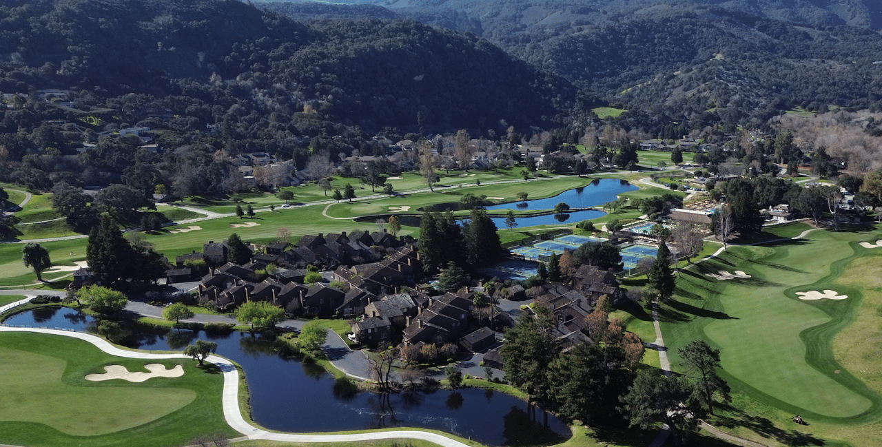
The other change residents already hear, if not yet see, is a mile and a half downstream. The Rancho Cañada Floodplain Restoration Project at the Palo Corona Regional Park unit is now in active construction, converting the former 36-hole Rancho Cañada Golf Club property into reconnected floodplain. In-channel gravel is being added to raise the water surface upstream, three former golf cart bridges are being retired, and one new pedestrian bridge is being constructed rated for emergency vehicle access to support public access to 4,500 acres of Palo Corona Regional Park.
That is happening outside Garland's boundary, but Garland is where the difference will land first. As the Carmel River regains room to move, the willow and cottonwood stands along the lower Garland reach behave differently in a wet year. The Rancho Cañada project is reconnecting 40 acres of floodplain habitat, 7,600 feet of restored river corridor, and 175,000 native plants. Residents who walk the lower Garland loops in February will notice the flow patterns change first.
The Wednesday Morning That Still Works
Set against everything above, the case for a mid-week walk has actually gotten stronger. The Visitor Center is closed Monday through Wednesday, which means the parking lot is quieter, the year-round steel bridge is uncrowded, and the Lupine Loop is a walking-with-your-own-thoughts trail rather than a shared-with-strangers one. If you want the docent conversation, come Thursday. If you want the trail, come Tuesday.
The Waterfall Trail continues to depend on rain. Seeing the 70-foot Garland Ranch Falls perform requires serious timing right after a heavy rain, and this year's late-summer stretch, as usual, will offer the trail without the water. That is not a change. That is the park's oldest rhythm.
What has shifted is the surrounding infrastructure. The Visitor Center window narrowed. The seasonal bridge is out. The volunteer trail program is running a second round. The LGO! catalog wants you registered by 4 p.m. the day before. Across the river, a golf course is becoming a floodplain again. None of these are dramatic on their own. Together they describe a park that is being managed with more visible calendar structure than it was five years ago, and that structure rewards the resident who reads the e-news over the resident who shows up unannounced.
The 50 miles of hiking and riding trails remain the reason to live within a short drive of 700 West Carmel Valley Road. The rest is scheduling.
If you own along Carmel Valley Road, in Tierra Granda, Quail Meadows, or the hills above the park, and you are thinking about how the property market here reads against these quieter, structural shifts, the team at Truszkowski Freedman & Associates is available for a private conversation. Work With Us.